Hurghada
Hurghada (الغردقة al-Ġardaqa, ) is a city in the Red Sea Governorate of Egypt. It is one of the country's main tourist centres located on the Red Sea coast.
Hurghada was founded in the early 20th century. For many decades it was a small fishing village, but it has grown into a major Red Sea resort as a result of Egyptian and foreign investment that began in the 1980s. Holiday resorts and hotels provide facilities for windsurfing, kitesurfing, yachting, scuba diving and snorkeling. The city is known for its watersports, nightlife and warm weather. Daytime temperatures are around 30 °C most of the year, and during July and August temperatures can reach over 40 °C. Hurghada is a popular holiday destination for Europeans, especially during the winter, and some spend Christmas and New Year there. Tourist numbers from Russia dropped significantly after the Metrojet Flight 9268 plane crash in November 2015.
Hurghada extends for about 36 km along the coast, but does not reach far into the surrounding desert. The resort is a destination for Egyptian tourists from Cairo, the Delta and Upper Egypt, as well as package holiday tourists from Europe. Hurghada has a population of 248,000 and is divided into:
* El Ahia and El Helal – the northern part
* El Dahar (Downtown) – the old town
* Sakala – the city center
* El Kawsar – the modern part
* El Mamsha (Village Road) – a pedestrianised street with a length of over 4 km
Many of Hurghada's newer hotels, restaurants, and shops are located along El Mamsha. Most of the newest and largest hotel resorts are located in the area between Mamsha and Sahl Hasheesh on El Mamsha. Beyond Sahl Hasheesh there are the hotels of Makadi Bay. Dahar is the oldest part of the town where the town's traditional bazaar, the post office and the long-distance bus stations (Go Bus and Upper Egypt Bus) are situated. The busiest area is Sakala, the "city center" on Sheraton Road, where there are hotels, shops and restaurants.
The city is served by the Hurghada International Airport with scheduled passenger traffic connecting to Cairo and directly to several cities in Europe. A new terminal was opened in 2015 to accommodate increasing traffic.
Map - Hurghada
Map
Country - United_Arab_Republic
 |
 |
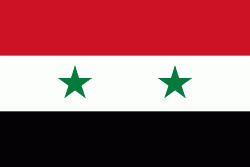
| Flag of Egypt | |
The republic was led by Egyptian President Gamal Abdel Nasser. The UAR was a member of the United Arab States, a loose confederation with the Mutawakkilite Kingdom of Yemen, which was dissolved in 1961.
Currency / Language
| ISO | Currency | Symbol | Significant figures |
|---|---|---|---|
| EGP | Egyptian pound | £ or جم | 2 |
| ISO | Language |
|---|---|
| AR | Arabic language |
| EN | English language |
| FR | French language |


